

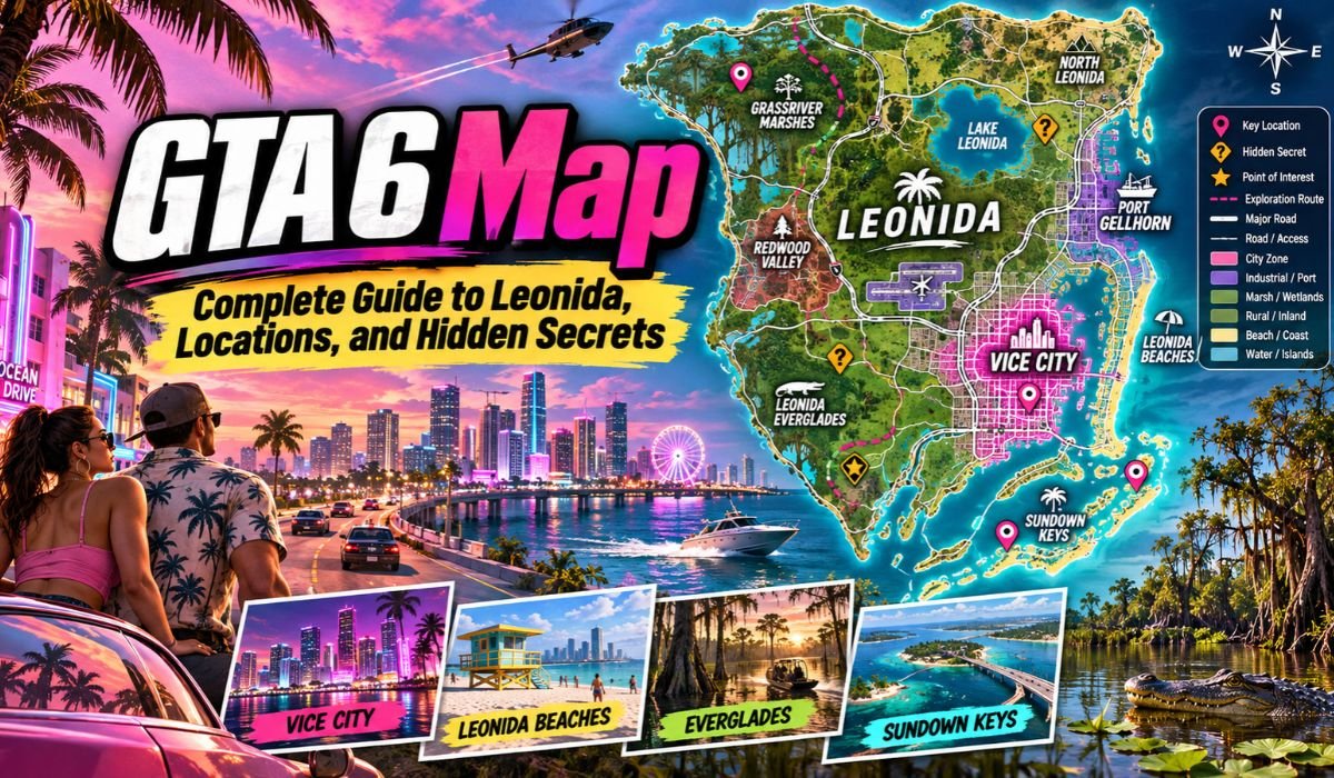
The GTA 6 Map takes the Grand Theft Auto series into Leonida, a fictional American state inspired by Florida. It’s a setting built around contrasts. One moment, players can find themselves surrounded by the neon glow and crowded streets of Vice City; the next, the landscape opens into tropical islands, sprawling wetlands, industrial communities, or forested wilderness.
Vice City is naturally the headline attraction. Rockstar Games’ fictional take on Miami has a long history in the series, and its return gives GTA 6 an instantly recognizable center. This time, though, the city is only one part of a much broader world. Leonida stretches well beyond the familiar beaches and high-rises into places with their own geography, culture, and atmosphere.
That variety is what makes the map particularly interesting. Instead of focusing only on raw size, it’s more useful to look at how Leonida is divided, what players can find in each region, and how its locations fit together.
This guide covers the GTA 6 Map Size, Vice City, Leonida Keys, Major Locations, Interactive Map Features, Hidden Secrets, and the most important differences between GTA 6 and GTA 5. Where community estimates or third-party map data are involved, those details are identified separately from official Rockstar information.
Quick Information About the GTA 6 Map
Game: Grand Theft Auto VI
Developer: Rockstar Games
Publisher: Rockstar Games
Setting: Leonida
Main City: Vice City
State Inspiration: Florida
City Inspiration: Miami
Southern Islands: Leonida Keys
Wetlands: Grassrivers
Coastal Town: Port Gellhorn
Industrial Area: Ambrosia
National Park: Mount Kalaga
World Type: Open World
Major Highlighted Regions: Six
Main Map Comparison: GTA 5
Map Size: Estimates Vary
Interactive Map Resource: GTABase
Location Tracking: Available Through Third-Party Tools
What Is the GTA 6 Map?
The GTA 6 Map represents Leonida, the fictional state in which Grand Theft Auto VI takes place. Rather than building the world almost entirely around one metropolitan area, Rockstar has created a broader setting that combines dense city neighborhoods with coastal communities, industrial districts, wetlands, islands, and wilderness.
Official setting information highlights six major regions: Vice City, Leonida Keys, Grassrivers, Port Gellhorn, Ambrosia, and Mount Kalaga National Park.
Each gives Leonida a noticeably different character. Vice City channels the energy and appearance of Miami, while Grassrivers draws heavily from Florida’s Everglades. Head farther north and Mount Kalaga introduces forests, rivers, and outdoor landscapes that feel far removed from the crowded coastal city.
That contrast matters. A large map can quickly feel empty when every area looks and plays the same. Leonida instead appears designed around recognizable regional identities, giving players a reason to explore beyond Vice City rather than simply travel longer distances.
Where Is GTA 6 Set?
Grand Theft Auto VI is set in Leonida, Rockstar’s fictional interpretation of Florida. Anyone familiar with the real state will recognize some of the inspiration immediately: tropical beaches, palm-lined streets, wetlands, coastal highways, islands, waterways, and densely populated urban areas all help shape the setting.
At the center is Vice City, a fictional metropolis inspired by Miami. Its waterfront scenery, colorful architecture, nightlife, commercial districts, and mix of neighborhoods give the city a strong South Florida identity.
Leonida becomes more varied once players leave the city. The Leonida Keys take inspiration from the Florida Keys, while Grassrivers echoes the wetlands of the Everglades. Elsewhere, industrial communities, Gulf Coast settlements, and northern wilderness expand the world beyond the tropical-city image most closely associated with Vice City.
Leonida isn’t meant to be a street-for-street recreation of Florida. Rockstar uses real geography and culture as a foundation, then reshapes those influences into a fictional state suited to Grand Theft Auto’s characters, storytelling, exploration, and satire.
How Big Is the GTA 6 Map?
The GTA 6 Map Size has naturally become one of the biggest talking points surrounding the game. Community comparisons indicate that Leonida is substantially larger than the playable world of GTA 5, although the exact figure depends on which measurement is being used.
The supplied GTABase information estimates Leonida at roughly 1.7 times the size of GTA 5’s map. Another widely discussed community estimate puts the figure closer to 2.4 times larger.
Those numbers shouldn’t be treated as equivalent measurements. Map comparisons can change significantly depending on whether they count only land, include surrounding water, measure total boundaries, or focus specifically on accessible gameplay space. Until figures are compared using the same method, a precise percentage can create more confusion than clarity.
Size also tells only part of the story. A huge landscape isn’t automatically a better open world. What matters is what fills that space. Leonida’s combination of cities, islands, wetlands, highways, coastal communities, and wilderness could make its scale meaningful because different parts of the map offer noticeably different surroundings.
GTA 6 Map vs GTA 5
Looking at the GTA 6 Map vs GTA 5 shows how differently Rockstar has approached the geography of the two games.
GTA 5 takes place in San Andreas, a fictional state heavily influenced by Southern California. Los Santos dominates its southern portion, while mountains, deserts, countryside, highways, and smaller communities spread across the rest of the map.
GTA 6 moves to the Florida-inspired Leonida. The change in location replaces much of GTA 5’s dry, mountainous scenery with tropical coastlines, wetlands, islands, waterways, and a Miami-inspired urban center.
The wilderness is different, too. GTA 5 players will remember Mount Chiliad and the open spaces of Blaine County. In GTA 6, places such as Grassrivers and Mount Kalaga National Park offer a different interpretation of life outside the city, ranging from swampy wetlands to wooded northern landscapes.
The better comparison, then, isn’t simply which map covers more square miles. Road networks, environmental density, accessible locations, activities, traffic, landmarks, and the amount of meaningful content between destinations all influence how large an open world actually feels while playing.
All Major GTA 6 Map Regions Explained
Rockstar has highlighted six major regions within Leonida, and each one gives players a different view of the fictional state.
Vice City is the urban centerpiece. Inspired by Miami, it brings together beaches, nightlife, commercial districts, waterfront scenery, and a dense metropolitan skyline.
Leonida Keys stretches south into an island environment inspired by the Florida Keys. Coastal roads, waterways, bridges, and smaller communities give this region a more relaxed visual identity than central Vice City.
Grassrivers represents Leonida’s wetlands. Its Everglades influence can be seen in the swampy terrain, waterways, vegetation, and wildlife.
Port Gellhorn sits on the Gulf Coast and has a more weathered personality. Its aging tourism infrastructure and roadside businesses set it apart from Vice City’s polished waterfront image.
Ambrosia reflects the industrial and agricultural side of Leonida. The region is closely associated with its sugar refinery, giving it a working-town character rather than a tourism-focused one.
Finally, Mount Kalaga National Park introduces forests, rivers, trails, and outdoor recreation. It provides one of the clearest geographical contrasts with the tropical urban environments farther south.
Together, these regions help Leonida feel less like one oversized city and more like a fictional state made up of genuinely different places.
Vice City Map: The Heart of GTA 6
Vice City remains the most recognizable location on the GTA 6 Map, and for good reason. Rockstar’s Miami-inspired metropolis combines beaches, high-rise buildings, nightlife, busy streets, waterfront districts, and neighborhoods with their own visual character.
The city isn’t presented as uniformly glamorous. Official setting material shows both its polished tourist image and less pristine areas, giving Vice City more texture than a simple collection of beaches and nightclubs.
Locations such as Ocean Beach and Little Cuba help establish that variety. The city’s skyline and coastline also make it an easy geographical reference point when trying to understand how the wider Leonida map fits together.
For longtime Grand Theft Auto fans, the return carries additional significance. Vice City has been part of the franchise for decades, but GTA 6 places it inside a far broader world than earlier versions.
New players don’t need that history to appreciate it, though. Vice City works as Leonida’s metropolitan anchor, while the surrounding regions demonstrate just how much farther the game extends.
Leonida Keys and Coastal Islands
South of Vice City’s urban landscape, the Leonida Keys introduce a distinctly tropical side of the map.
Inspired by the Florida Keys, the region is characterized by islands, coastal roads, small communities, bridges, shorelines, and extensive waterways. Its geography immediately separates it from the dense streets and high-rise development found in Vice City.
Water is naturally an important part of the landscape here. The layout of the islands makes coastal routes and connections between communities particularly noticeable, while the surrounding ocean helps give the Keys their own sense of place.
The region also has a narrative connection to the game’s characters. Rockstar’s official character material establishes that Jason Duval spent time in the Keys working with local drug runners, including Brian Heder. That detail makes the Leonida Keys more than an attractive backdrop; they’re also connected to the wider story.
Grassrivers, Port Gellhorn, and Mount Kalaga
Some of the GTA 6 Map’s most distinctive scenery appears once players move away from Vice City and the Keys.
Grassrivers is Leonida’s wetland region, drawing clear inspiration from the Florida Everglades. Waterways, vegetation, swampy terrain, and wildlife define the landscape, creating an environment that feels dramatically different from the city.
Port Gellhorn offers another change of pace. This Gulf Coast community carries the appearance of a place whose better tourism days may be behind it, with older roadside attractions and businesses contributing to its weathered personality.
Then there’s Mount Kalaga National Park. Located in Leonida’s northern wilderness, the region introduces forests, rivers, trails, and rugged outdoor scenery. It broadens the visual range of the map and shows that Leonida isn’t limited to beaches, swamps, and urban development.
Ambrosia adds yet another layer. Its industrial and agricultural character, particularly the presence of a major sugar refinery, helps portray the working side of the fictional state.
These locations are important because they make the GTA 6 Map feel geographically connected without making every part of it look interchangeable.
GTA 6 Interactive Map Explained
A GTA 6 Interactive Map can be particularly useful for anyone trying to explore Leonida systematically. Community-maintained resources such as GTABase organize discovered locations into searchable categories and allow players to track what they’ve already found.
As of November 18, 2026, GTABase listed 937 locations across 38 categories. The database covers businesses, landmarks, services, activities, and other points of interest scattered around Leonida.
Its map includes filters that allow users to hide categories they don’t currently need. Instead of filling the screen with every known marker, for example, players can concentrate on a particular type of location.
Progress tracking is another useful feature. Users can mark places as found, while registered members can synchronize their progress between devices. Guests can still track discoveries through their browser.
Personal markers, favorites, and private notes provide additional ways to organize exploration.
One distinction is important here: GTABase is an independent community resource. Its interactive map, marker database, and tracking tools aren’t the same thing as Rockstar’s built-in GTA 6 map.
GTA 6 Map Locations and Important Landmarks
The range of GTA 6 Locations documented by community resources gives some sense of how densely populated Leonida can be.
According to GTABase’s November 18, 2026 listing, the interactive map contained 115 bars, 111 street-food locations, 80 cafes and takeout businesses, 70 clothing stores, 70 convenience stores, and 59 gas stations.
The database also tracks hospitals, police stations, public transportation points, marinas, entertainment venues, shops, and landmarks.
Those numbers are useful for understanding the variety of places documented by the community, but they require some context. A marker on an interactive map doesn’t automatically mean a building has a fully accessible interior or that every business offers a specific gameplay function.
That’s particularly important when using third-party maps. They can be excellent tools for finding places, but official game information and direct gameplay evidence remain the stronger sources for confirming what players can actually do at each location.
Safehouses, Garages, and Vehicle Services
Vehicle-related locations are naturally important in a Grand Theft Auto game, especially when the world is large enough to encourage long-distance travel.
GTABase’s November 18 map listed four safehouses, thirteen garages, sixteen mod shops, nineteen Pay ‘n’ Spray locations, and two vehicle dealerships.
Other documented categories include gas stations, car washes, marinas, and public transportation locations.
These markers can make an interactive map much easier to use. Someone looking specifically for vehicle-related services can filter out unrelated restaurants, shops, and entertainment locations rather than searching through hundreds of markers.
It’s still worth being cautious about functionality. A location’s name or map category doesn’t necessarily prove that it works exactly like a similarly named business in an earlier Grand Theft Auto game. GTA 6 has its own systems, and gameplay functions should be confirmed independently.
GTA 6 Map Activities and Exploration
Leonida’s biggest strength may ultimately be the number of different environments players can encounter during ordinary exploration.
Vice City offers dense urban neighborhoods, commercial areas, entertainment districts, nightlife, and waterfront scenery. Drive away from the city and the experience changes. The Leonida Keys bring islands and coastal communities, Grassrivers shifts toward wetlands and wildlife, and Mount Kalaga introduces a much more rugged outdoor landscape.
Community map databases also document locations connected with golf, gyms, marinas, entertainment, shopping, food, and criminal activity.
That variety gives players reasons to leave the obvious routes. Instead of treating Leonida as a checklist of map markers, it can be more rewarding to learn individual regions gradually.
Exploring one area at a time also makes practical sense. Learning major roads and recognizable landmarks before moving farther away can make navigation easier, especially in a world with several distinct regions.
GTA 6 Hidden Secrets and Collectibles
The search for GTA 6 Map Secrets is already an important part of the wider community conversation.
GTABase’s November 18 database included five markers in its hidden-package category, alongside hundreds of other documented locations. Those five markers shouldn’t automatically be interpreted as the complete number of hidden packages or collectibles in GTA 6, however. Community maps continue to change as information is verified and added.
Leonida’s geography naturally encourages curiosity. Remote islands, wetland waterways, isolated roads, forests, industrial areas, and unusual landmarks all provide potential places for players to investigate.
The challenge is separating genuine discoveries from speculation.
Grand Theft Auto games have a long history of Easter eggs and unusual details, which makes rumors spread quickly. For a reliable GTA 6 guide, a secret should be treated as confirmed only when there is dependable gameplay evidence behind it.
For completion-focused players, accurate information is far more useful than exaggerated claims about mysterious locations that may not exist.
How to Explore the GTA 6 Map
Understanding Leonida’s regional layout can make exploring the GTA 6 Map considerably easier.
Vice City works as a natural urban reference point. To the south, the Leonida Keys lead into tropical island territory. Elsewhere, players can encounter wetlands, coastal towns, industrial communities, and the northern wilderness around Mount Kalaga.
Interactive map filters are particularly helpful when searching for something specific. A player interested in vehicles can concentrate on garages, dealerships, and mod shops, while someone looking for sightseeing opportunities can focus on landmarks instead.
Tracking visited locations can also reduce unnecessary backtracking, particularly for players interested in thoroughly exploring Leonida.
Travel times require more caution. The time needed to cross the map isn’t determined by physical distance alone. Road design, traffic, vehicle choice, route selection, and starting and ending points can all make a substantial difference.
For that reason, measured gameplay tests are more reliable than estimates based solely on screenshots or reconstructed maps.
GTA 6 Map Updates and Future Discoveries
The picture of Leonida will continue to become clearer as players document additional locations and community mapping projects refine their information.
Rockstar’s official material remains the strongest source for confirmed setting details, character information, and game features. Community projects such as GTABase serve a different purpose by cataloging individual locations and giving players practical tracking tools.
Both can be useful, but they shouldn’t be treated as interchangeable.
Interactive-map totals may change as new places are discovered, existing markers are corrected, or categories are reorganized. That’s why a location count should always be accompanied by the date on which it was recorded.
The same principle applies to map-size estimates. Community measurements can provide useful context, but unless Rockstar publishes an official measurement or researchers use a consistent methodology, exact percentages should remain clearly labeled as estimates.
Rockstar’s official website lists November 19, 2026, as the release date for Grand Theft Auto VI on PlayStation 5 and Xbox Series X|S.
Final Thoughts on the GTA 6 Map
The GTA 6 Map is impressive not simply because Leonida is large, but because the state brings together environments that feel noticeably different from one another.
Vice City provides the energy of a major coastal metropolis. The Leonida Keys shift the scenery toward tropical islands and waterways. Grassrivers introduces wetlands and wildlife, while Port Gellhorn offers a weathered Gulf Coast atmosphere. Ambrosia reflects the state’s industrial side, and Mount Kalaga National Park takes players into forests and rugged northern landscapes.
Comparisons with GTA 5 are inevitable, and they can be useful for understanding the general scale of the new world. Still, raw map size isn’t the best measure of an open world’s quality. What ultimately matters is how much there is to discover, how naturally locations connect, and whether traveling between them remains interesting.
Interactive maps can make that exploration easier, particularly for players trying to track landmarks or work toward thorough completion. At the same time, third-party databases should be treated as evolving resources rather than official records.
That’s especially important in 2026, when new discoveries can quickly change what the community knows about Leonida. Official Rockstar information provides the foundation, while verified gameplay and carefully maintained community resources can fill in the smaller details.
In the end, the appeal of the GTA 6 Map isn’t just about reaching the opposite side of Leonida. It’s about everything players encounter along the way—from crowded Vice City streets and tropical coastal roads to quiet wetlands, industrial communities, and remote wilderness. That variety is what gives Leonida the potential to become one of the most memorable settings in the Grand Theft Auto series.
FAQs About the GTA 6 Map
Is the GTA 6 Map Bigger Than GTA 5?
Community measurements indicate that Leonida is larger than GTA 5’s San Andreas map, but estimates differ. Some measurements count only land, while others may include water or the wider playable area. For that reason, unofficial percentages should be treated as estimates rather than exact Rockstar-confirmed figures.
Where Is GTA 6 Set?
GTA 6 takes place in Leonida, a fictional American state inspired by Florida. Vice City is its best-known urban center and takes strong inspiration from Miami, including its beaches, architecture, nightlife, and tropical surroundings.
What Are the Main GTA 6 Map Regions?
Rockstar has highlighted six major areas: Vice City, Leonida Keys, Grassrivers, Port Gellhorn, Ambrosia, and Mount Kalaga National Park. Together, they cover urban, coastal, wetland, industrial, island, and wilderness environments.
Does GTA 6 Have an Interactive Map?
Third-party websites such as GTABase provide GTA 6 interactive maps with searchable locations, filters, personal markers, and progress tracking. These community tools are separate from Rockstar’s own in-game navigation system.
Are There Hidden Locations in GTA 6?
Community maps document hidden packages and other unusual points of interest. However, not every rumored secret found online is genuine. Hidden locations and Easter eggs are best considered confirmed when reliable gameplay evidence supports them.
Can Players Explore Beyond Vice City?
Yes. Vice City is only part of Leonida. Other highlighted regions include the Leonida Keys, Grassrivers, Port Gellhorn, Ambrosia, and Mount Kalaga National Park, giving players access to environments ranging from tropical islands to forested wilderness.
How Many Locations Are on the GTA 6 Map?
GTABase listed 937 locations across 38 categories as of November 18, 2026. That figure represents locations documented on its third-party interactive map at that particular time. It shouldn’t be interpreted as Rockstar’s official total for every location in GTA 6.
How Long Does It Take to Cross the GTA 6 Map?
There isn’t one universal travel time for crossing Leonida. The result depends on the starting point, destination, route, vehicle, traffic, and road network. Measured gameplay tests provide a more meaningful answer than estimates based on map images alone.
Learn more and explore exciting content on: GTA 6 Pre Order: Latest Sales Figures, Release Date, and Everything You Need to Know